
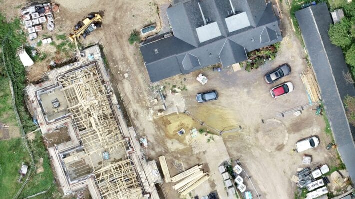
Accurate
Survey grade accuracy to 3cm and better
Efficient
Rapid UAV data collection technology
Measurable
Get distance, area & volumes
Accessible
Viewable interactively across all devices
Precise and repeatable surveys every time
Efficient data capture in one pass
Safely work in dangerous or inaccessible environments
1ha to 1000ha with no loss of detail
Resolutions 100x greater than common desktop mapping
Repeat & compare project changes overtime
Achieve survey precision down to just 2-3cm
Produce contour maps at any practical interval required
3D data allows for precise calculations of areas & volumes
| Cookie | Duration | Description |
|---|---|---|
| cookielawinfo-checbox-analytics | 11 months | This cookie is set by GDPR Cookie Consent plugin. The cookie is used to store the user consent for the cookies in the category "Analytics". |
| cookielawinfo-checbox-functional | 11 months | The cookie is set by GDPR cookie consent to record the user consent for the cookies in the category "Functional". |
| cookielawinfo-checbox-others | 11 months | This cookie is set by GDPR Cookie Consent plugin. The cookie is used to store the user consent for the cookies in the category "Other. |
| cookielawinfo-checkbox-necessary | 11 months | This cookie is set by GDPR Cookie Consent plugin. The cookies is used to store the user consent for the cookies in the category "Necessary". |
| cookielawinfo-checkbox-performance | 11 months | This cookie is set by GDPR Cookie Consent plugin. The cookie is used to store the user consent for the cookies in the category "Performance". |
| viewed_cookie_policy | 11 months | The cookie is set by the GDPR Cookie Consent plugin and is used to store whether or not user has consented to the use of cookies. It does not store any personal data. |